Monadnock Hours
July 29, 2019: Starting from the parking lot on Rte 124, a friendly gatekeeper asks if we have any dogs and peers in the back seat (happily, we don’t; pets are not permitted in the park).
Monadnock is the perfect little mountain, a Katahdin in miniature perhaps, less than two hours from the city, tantalizingly visible from the approach roads (just like its formidable Maine cousin), handsome in its way and well-formed, a broad wooded shoulder (when viewed from the south) and bare shapely rock summit, having a variety of terrain, pleasant wooded walks with fieldstone walls and granite slab bridges over mossy streams, steep scree falls on the upper shoulder with occasional runs of man-made stone steps, steep defile on the summit approach, bare rounded fields of stone up top, 360 views (it’s a monadnock!) and on the way down, steeply sloping granite ledges interspersed among the trees and giving upon vistas of blue misty woods and distant mountains broken by occasional lakes and rivers, and for the final leg, an access road (to a private dwelling within the park!) paralleling the trail, an easy walk out and down to the parking lot.
Hiking with Chris, an easy, genial trail companion, talk or silence is comfortable…we step off the road immediately and take a gentle upward trail through the woods. As always, I congratulate myself on knowing the parking lot and this “secondary” route: many hikers take the access road to the White Arrow Trail. But there aren’t many hikers because the parking lot is small and not even full. It’s relatively cool (high 70s), and the air quality is better than in town. But I start slow, as usual, not feeling particularly light or flexible, and work my way into it. I let Chris lead because I want to dawdle unperceived. By the time we get back to the road (after a leisurely detour to the west and a stretch of more or less level trail through the woods), I’m warmed up (though not overheated) and comfortable and ready for the challenging part (which turns out not to be, really).
It’s 100 yards up the road to the beginning of the White Arrow Trail (which we end up following to the summit), a climb up what seems like (but isn’t?) the increasingly steep rocky bed of a wide stream. Then, woods with massive outcroppings (or glacial erratics), some creating little grottoes with damp mossy faces, and then some steep scree falls (with occasional runs of man-made stone steps) to the shoulder where we emerge from the trees and see the bare summit of the mountain above us, with people (but not so many) perched here and there about it.
Granite (?) slabs are covered with little worm-like protrusions, as though I’m looking down on them through a shallow paleogeologic sea. Fossils?
Increasingly exposed and breezy (but most pleasant) trek to the summit. I want to stop for lunch just below the top (where Mark U and I used to lunch), but a fall of rock has literally obliterated our spot. The mountain is walking! Some reflections about the way the appearance of the mountain changes from year to year: from the shoulder, layers of granite are visible on steeply sloping ledges, and some pieces (the size of a small car) of the upper ledges have become detached, and moved downward upon the lower layers, ready to hurl themselves off the mountain. The trail avoids these places, advisedly, I assume.
The top is pleasant, not too hot, not too cool, and surprisingly sparsely populated (the World is here, but not his Wife). We lunch there (I’ve forgotten garden tomatoes and regret not boiling an egg: I’ve waived the sandwich too and content myself with 3 baby Bellas and Finn crackers—an overreaction to bringing too much food on my overnight to Sage’s with Alan. I did bring potato chips though, but nothing fresh, no fruit either. Treat yourself better on future day hikes. Weight is not an issue.)
Down the Dublin/Marlborough trail (my lightly traveled route, upon which I again congratulate myself, a long leg to the west to pick up a secondary called Marian, derived from a colored-coded map that I must have copied from the Web). And in the same place where Mark U and I once encountered barefoot hikers—a family of 4, mother (barefoot) carrying baby daughter in a sling in front of her, father (shod) with 5 or 6-year-old (barefoot). I conceal my disapproval behind some cheerful questions. (does the front sling work better than the back? Baby likes it better.) Down through gullies running in the direction of the descent, some filled with muddy water (a rainy summer), to the Dublin/Marlborough fork, marked with a huge cairn and a signpost (and some rocks defaced by the pathetic message ‘I miss you, Heidi’), Dublin heading north on a ridge, Marlborough down and west…
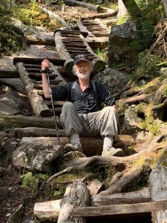
The tree line is really a line, and we enter the shade. The trail is still a jumble of protruding rocks. Sometimes, my staff helps; sometimes, it’s an impediment. I take my hand out of the strap, and that is better: I can shorten it up as needed. My new gloves work well: I frequently put my left hand down without fear of tearing it up.
Flat ledges interrupt the woods, from which the views still open out. And very low bush blueberries growing ripe close to the warm stone: we gather handfuls. Sometimes, on this descent, the trail is not well-marked, with cairns rather than painted marks being used on the ledges. The junction with Marian has a series of large cairns, and I’m relieved to see the directions in large painted white letters on the rock floor: I wanted it in writing.
In the woods, the air is still, and I feel the increasing humidity. But my ‘wet towel’ works well: I use some of my water to soak it again in its bag and wrap it around my head: it’s especially good whenever I catch a breath of wind on an exposed ledge…
The trail evens out, with only occasional outcroppings (though we pass a steeply sloping rock plane that I once slid down with feet braced against my chest—and ended up with crippling cramps, no pickle juice, I have to walk it off. This time, the cramps catch up to me when I hunker down to gorge on the blueberries—but I’ve come prepared!)
Through the woods, finally swinging east to cross a (motionless) stream by way of massive granite field slabs, down by Mossy Stream trail, an alternative to a more direct trail that involves elevation (no!), coming finally to Cart Path (but how in the name of God…? There are still large boulders in the way: I imagine a couple of guys hefting a handcart…) Massive field stones in rambling walls through the woods: was this once pasture? If so, they didn’t get all the stones. Finally, the road again, and I’m ready to take it. As usual, it’s longer than I think: I hallucinate the port-a-potty and the cars in the parking lot long before the turn that finally reveals them.
Always thankful now, unlike unthinking youth, to have returned in one piece, all parts still in working order. How well I have come to know—and love!—this obliging little mountain.
Lest I forget: “In mountain groves, grasslands, and woods, the truth has always been exhibited.” While trailing Chris in silence, I was able to take a little time to practice, too, trying to “discern and comprehend the broad, long tongue of the Buddha’s teaching, which cannot be muted anywhere.” The body of the mountain, the “net” of roots and rocks, the encompassing woods—and hills—and sky: What is this that thus comes? Who is it that perceives all this? Who is perceived?

